


National Zoning Atlas Launched to Make America's Patchwork of Codes Accessible and Comprehensible
Professor of City and Regional Planning Sara Bronin's zoning atlas initiative is a first-of-its-kind effort to translate and standardize zoning codes across the U.S. into a single, accessible online resource.
Zoning laws, adopted by thousands of local governments across the country, dictate much of what can be built in the United States. Zoning codes have major ramifications for businesses, housing, and quality of life but can be very difficult for non-experts to understand.
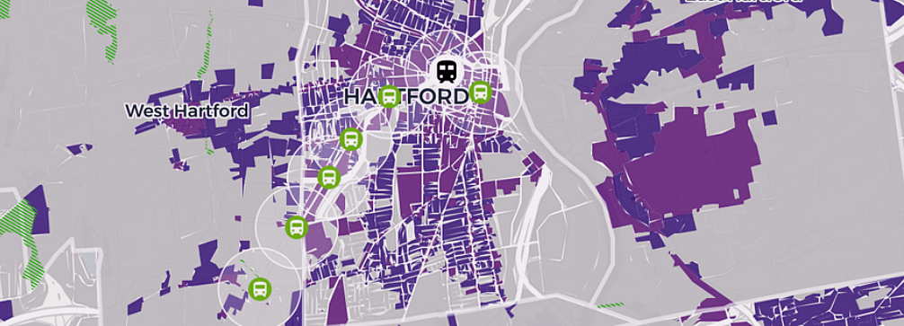
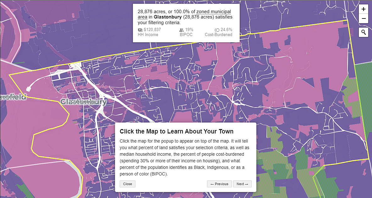
To address this information gap, the Legal Constructs Lab, directed by CRP Professor Sara Bronin, has launched a National Zoning Atlas that enables people to better understand zoning codes and their regulatory constraints.
"We envision the National Zoning Atlas as the Rosetta Stone of zoning: translating complex, technical, bureaucratic jargon into easy-to-understand maps and graphics," said Bronin, who is also on the faculty of the Cornell Law School and brings her property law expertise to the project. "Once we get a critical mass of jurisdictions incorporated into the National Zoning Atlas, we'll be able to unlock tremendous, unprecedented secondary research in housing, education, transportation, environmental policy, climate response, economic development, and much more."
Bronin's team has established a standard methodology for data collection based on the Connecticut Zoning Atlas. It is also spearheading the New York Zoning Atlas, with initial funding from the Cornell Mui Ho Center for Cities, which launched on April 19 at the College of Architecture, Art, and Planning. The center aims to help policymakers, communities, and other collaborators address urgent challenges facing cities around the world — from climate adaptation to urban mobility to clean air and water.
"The National Zoning Atlas and the work of Sara and her team so clearly encapsulate the type of collaborative, cross-disciplinary approach needed to fully understand our current challenges so that we can build sustainable, livable places," notes CRP Chair and Professor Sophie Oldfield. "It also illustrates the immense potential of the new Cornell Mui Ho Center for Cities, a space for CRP faculty to come together with other experts to generate high-impact, actionable knowledge across a wide range of essential questions facing our communities."

Additional teams from Hawaii, Montana, New Hampshire, and Ohio are creating zoning atlases using National Zoning Atlas methods.
At a minimum, these atlases will enable users to:
- Determine whether each district allows one-, two-, three-, or four-or-more-unit housing.
- Know if housing is subject to a public hearing or has lot-size restrictions.
- Understand various rules on building accessory dwelling units (small spaces that have become increasingly popular as rental properties or apartments for older relatives).
- Understand minimum parking requirements, height caps, lot coverage requirements, floor-to-area ratios, and more.
To build out this critically important public resource, the Legal Constructs Lab is calling for research collaborations with academic, government, nonprofit, private sector, and funding partners who share an interest in partnering with existing teams or in creating new teams at statewide or regional levels.
When the National Zoning Atlas is complete, it will enable comparisons across jurisdictions, illuminate regional and statewide trends, and strengthen national planning for housing production, transportation infrastructure, and climate response.
Beyond these practical outcomes, researchers expect that a national atlas will democratize zoning information and thus participation in land use decisions, inform zoning reform advocacy, and narrow a wide information gap that currently favors land speculators, institutional investors, and homeowners over socioeconomically disadvantaged groups.
Stay connected! Follow @cornellaap on Instagram, Facebook, Twitter, and LinkedIn; and subscribe to our AAP bi-weekly newsletter.


